TL;DR
The lowest May hurricane number in a decade landed yesterday, and what households got Friday was a beach advisory.
MSM Perspective
WTSP and Naples News led with 'below-normal good news'; WUSF carried Friday's Gulf-coast rip-current advisory.
X Perspective
X read NOAA's print as either climate-denial vindication or quiet-season complacency; the rip-current bodies in Florida belonged to neither argument.
NOAA's Atlantic Hurricane Outlook printed Thursday at eight to fourteen named storms, three to six hurricanes, and one to three majors — the lowest May figure in a decade and the central case in the agency's seventy-percent confidence band. [1] Friday was Day One of households living with the number. What they got from their state governments was the rip-current advisory the Gulf Coast already wakes up to. Florida, Louisiana, Texas, and the Carolinas — the four states the paper's Thursday major asked the watch question about — did not issue a state-level pre-position artifact off the print. The institutional gap the paper named is what the calendar inherited.
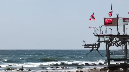
What did issue was the beach. WUSF reported Friday morning that "dangerous rip currents and thunderstorms may interrupt Memorial Day weekend plans" for the Florida Gulf coast and Panhandle, with double-red flags raised at several lifeguard stations. [2] AccuWeather repeated its El Niño caveat — that a below-normal season is not a no-risk season, and that the Gulf Coast from Louisiana to the Florida Panhandle and the Carolinas remain the high-risk rapid-intensification corridors regardless of the headline number. [3] CDC counts roughly four thousand unintentional drowning deaths annually, with children one to four the highest single-cause demographic; [4] Indiana Governor Mike Braun issued a drowning-prevention advisory Wednesday for distribution into the Memorial Day weekend. [5]
The four states the paper named did issue things. Florida's Division of Emergency Management posted its annual hurricane-preparedness page weeks ago; Louisiana refreshed its evacuation-routes map in April; Texas's Department of Emergency Management ran its standard public-information cycle through May; the Carolinas — both of them — held their schedules. What none of them did Friday was hold a press conference, declare a state of preparedness, or position resources off the NOAA print. The eight-to-fourteen number was lower than the agency's working frame of thirteen-to-nineteen, and the state-government response read as the headline number, not the rapid-intensification caveat.
The El Niño piece is the under-told part. NOAA's outlook keyed the lower headline number to the continuing influence of an El Niño signal at the Pacific helm, which historically suppresses Atlantic hurricane formation. [1] What El Niño does not suppress is sea-surface temperature in the Gulf of Mexico, the western Caribbean, and along the southeastern U.S. coast — the corridors where the season's storms, however few, are most likely to undergo the kind of rapid intensification that turned 2022's Ian and 2024's Helene into the category-three-and-up storms that drove the season's actual damage. [3] One major hurricane making landfall on a populated stretch of coast produces more household consequence than five tropical storms staying offshore. NOAA's print is the headline. The corridors are the policy.
The state-government silence Friday is the artifact. In 2024 — a forecast season of seventeen to twenty-five named storms — Florida's Division of Emergency Management and the Texas Department of Emergency Management both held Memorial Day preparedness press conferences. In 2026, with a number lower than the working frame, neither did. The political economy of a hurricane season scales with the headline number, not the corridor risk.
What households got Friday was operationally smaller than what they got in 2024. The beach advisories were the real-time service rail. The CDC drowning denominator was the parallel service note. The NOAA cone graphic — updated for 2026 to include inland watches and warnings — sat on the page. [6] The 1 June official start of the season is nine days away. Hurricane Melissa, the WeatherNext forecasting test case Google Hassabis name-checked at I/O Day 3 on Thursday, [7] is still the most-cited example of a five-day forecast saving institutional lives.
The CPC ENSO update due next month is the next clock. If El Niño holds, the eight-to-fourteen forecast is the central case. If it shifts to neutral or La Niña, the headline number rises. Either way, the rapid-intensification corridors do not change. The Florida lifeguards know it. The state emergency-management directors know it. Friday showed the policy response keys to the number, not the knowledge.
-- DARA OSEI, London
Sources & X Posts
News Sources