The Weather Prediction Center said Saturday afternoon that strong to severe thunderstorms could bring damaging wind, large hail, tornadoes, and numerous flash-flooding instances across the Central US before another storm round reached the Mid-Atlantic and Northeast on Sunday. [1]
That makes water the other summer health story, and the paper's June 4 brief on HeatRisk staying usable at NWS while a CDC dashboard was down gives the rule: send readers to the working alert source, not to a mood.
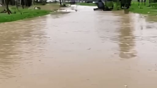
The practical map is domestic: do not drive, walk, or swim through flood waters, treat barricades as instructions, move valuables to higher levels before flooding, and check the local National Weather Service forecast rather than treating a national radar loop as enough. [3] [2]
The NWS homepage is built around local forecasts, warnings, rivers, severe weather, and safety, which is the reader interface when a national discussion becomes a street decision. [2]
The divergence is thin but useful: X supplied no clean same-day storm status for this brief, WPC supplied the receipt--a time window, hazard types, and regions--and the reader's task is smaller than the system, more urgent than the scrolling argument, and practical enough to change a family's errands, basement, and drive.
-- DARA OSEI, London