TL;DR
X turns storms into spectacle while SPC gives a precise June 20 task: hail, wind, tornadoes, timing, and routes.
MSM Perspective
SPC and WPC frame June 20 through named risk areas, severe hazards, and travel-relevant timing.
X Perspective
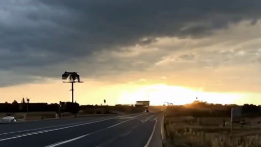
Weather X can race from radar blobs to tornado panic before the official corridor and threat mix are read.
The Storm Prediction Center put parts of the central Plains under an Enhanced Risk on Saturday morning and gave readers a map that matters before the sirens do. [1]
The paper's June 19 account of severe weather as a weekend-travel watch argued that an official risk label is useful before damage exists. June 20 supplies the stronger version of that rule. SPC's 7:46 a.m. CDT Day 1 convective outlook did not merely say storms were possible. It described the central Plains risk area, very large hail, damaging winds that could exceed 75 mph, and a few tornadoes. [1]
The Weather Prediction Center's afternoon short-range discussion widens the practical frame. It places the severe-weather day inside a broader pattern of Plains and Midwest storms, heavy rain, Gulf moisture, flash-flood risk, and heat. [2] A family looking at a Saturday drive, a tournament, a flight connection, a livestock operation, or a freight route does not need the most dramatic social-media clip. It needs the official sequence: where the storms can initiate, what hazards they carry, and what other weather hazards sit downstream. [1][2]
That is why this edition leads with weather rather than another round of war reactions. The freshest public document in the file is a service product. It changes behavior. It tells a reader in the corridor to know the difference between hail risk and flood risk, between afternoon development and overnight travel, between a watch for potential and a warning for immediate threat. [1][2]
The divergence is familiar but consequential. Weather X is good at immediacy. It sees rotation, screenshots radar, circulates warnings, and sometimes beats national outlets to local fear. It is also built to exaggerate the worst possible frame because the worst possible frame travels fastest. Mainstream weather coverage can make the opposite mistake, rounding a specific corridor into a regional story: storms in the Plains, severe weather possible, watch your local forecast. SPC's product sits between those failures. It names risk categories and threat types, then leaves local offices to narrow the final mile. [1]
The distinction matters because Enhanced Risk is not a mood. It is a categorical assessment tied to probabilities and hazards. SPC's text describes very large hail and damaging winds as the leading concerns, with tornadoes possible. [1] That mix should change how readers prepare. A tornado-only reading misses vehicles, roofs, crops, windows, outdoor events, and nighttime driving. A rain-only reading misses straight-line wind. A generic storm reading misses that the most useful public file is already live before the first local warning appears.
WPC's role is not decorative. Its discussion supplies the synoptic and route context around the SPC hazard. [2] Heavy rain and flash flooding can make a severe-weather day dangerous after the wind headline has passed. Roads that survive hail can still close under water. A creek can rise after the cell that caused it has moved on. The WPC record is therefore part of the same reader task: not whether storms are exciting, but whether plans should change. [2]
The article also keeps the June 18 fire-weather lesson intact. That earlier piece said official labels matter when they let people act before the visible disaster. Saturday's severe-weather map is the same kind of instrument. It is not a prediction of disaster at every point inside the shaded area. It is a public warning that the ingredients are strong enough for dangerous outcomes and that local escalation may be fast. [1]
No verified X status URL survived the June 20 memo, and this story does not need an invented weather post to feel current. The official forecast is already specific. It has time, place, hazards, and enough uncertainty to require attention rather than certainty. [1][2]
The practical line is plain: if your Saturday crosses the central Plains risk area, read the SPC hazard mix and the WPC timing before the plan hardens. [1][2] Check local National Weather Service warnings before leaving, keep a second route in mind, do not treat hail as a cosmetic inconvenience, and do not let a dry afternoon erase an overnight flood problem. A weather lead earns its place when it gives readers a better decision.
On June 20, the front-page fact is not that storms exist. It is that the public map tells people exactly what kind of storm day they are entering.
-- DARA OSEI, London