TL;DR
WPC tracks Arthur's rain totals and flood risk; the useful gap is gauge-by-gauge service coverage after the storm label stops helping.
MSM Perspective
WPC and NHC split the record between remnant status, rainfall totals, and excessive-rainfall products.
X Perspective
The WPC X post keeps the emphasis on dangerous flood threat, not on whether Arthur still carries a storm label.
Cottonport, Louisiana, had a preliminary storm-total rainfall report of 29.06 inches by Thursday night, and that number is more useful than Arthur's name.
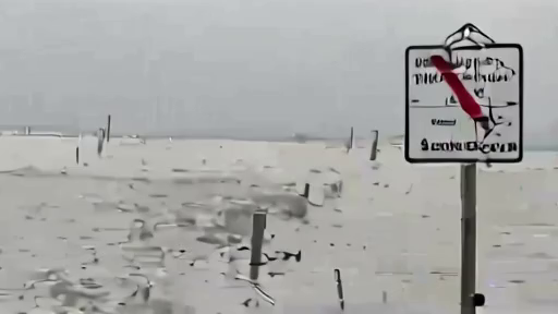
The paper's June 17 account of Arthur's label fading while the flood emergency grew argued that the reader needed water, roads, drains, rivers, and local instructions more than cyclone status. The Weather Prediction Center's Storm Summary Number 8 supplies the receipt: 29.06 inches near Cottonport, 22.53 inches at Plaucheville, 17.66 inches at the Atchafalaya River at Simmesport, and Mississippi reports above 12 inches at Perkinston and Black Creek [1].
That is not a naming debate. It is a gauge-by-gauge record of where the storm's afterlife became a civic problem.
WPC's live storm-summary page has since advanced, which is exactly why the stable public lesson is the gauge table rather than a single advisory timestamp. The same source preserves the severe totals, while WPC's excessive-rainfall outlook carried the operational warning: a High Risk over the central Gulf Coast and widespread, life-threatening flash flooding [1][2].
The excessive-rainfall outlook had already made the practical point. WPC placed a High Risk over the central Gulf Coast and wrote that widespread, life-threatening flash flooding was likely. It cited flash-flood emergencies in southeastern and central Louisiana and southern Mississippi, bands of backbuilding thunderstorms, a low-level jet off the Gulf, and record-level atmospheric moisture [2]. A name can dissipate; a moisture plume can still be doing work.
This is the gap the daily forecast often loses. Mainstream weather copy tends to sort Arthur through advisory status, watch type, and agency product. WPC's own X post did the useful thing: it kept the flood threat visible after Arthur's label became less informative. The paper's job is simpler: translate the warning back into amounts, places, and tasks.
The amounts are severe enough to require that discipline. The WPC discussion said rainfall rates of up to 3 inches per hour were already entering southeastern Louisiana, with saturated soils, flooding rivers, and nearly all heavy rainfall expected to convert to runoff [2]. The storm summary then showed what that process looked like once the gauges filled: more than two feet at Cottonport, nearly two feet at Plaucheville, and more than a foot in parts of Mississippi [1].
Preliminary does not mean ignorable. Rain gauges are revised, quality-controlled, and sometimes superseded, but the first public totals are how a community understands scale while the emergency is still active. A 29-inch line near Cottonport changes the conversation from "heavy rain" to homes, culverts, levees, drainage pumps, and roads that may fail in a sequence rather than all at once. The same is true when WPC names hourly rates. Up to 3 inches per hour is not a background shower. It is a pace at which a blocked drain or low road can become the whole story before a county alert catches up [2].
The storm summary also shows why statewide shorthand is too blunt. Louisiana had the biggest totals, Mississippi had multiple double-digit reports, and the downstream risk was moving through separate local warning products [1][2]. A reader in one state may be in damage assessment while a reader two states away is still deciding whether to drive. Arthur is the common label; the task is local.
The geography moves, but the lesson does not. A person in Louisiana may be asking whether a road, bayou, or low-water crossing has reopened. A person farther east may be watching a new local bulletin rather than yesterday's storm label. None of those decisions is improved by arguing over whether Arthur still sounds tropical enough.
The useful public sentence is not dramatic. Arthur's name has become less important as the water record has become more precise. Gauge totals tell the reader where the damage was; rainfall rates tell the reader where the risk is still moving. The storm label helps a map viewer find the system. The gauge tells a household whether the system has already arrived.
-- DARA OSEI, London
Sources & X Posts
News Sources