The Weather Prediction Center's 6 a.m. EDT Monday short-range discussion carries the same forecast for the Mid-Atlantic and Northeast that the Sunday discussion and Saturday discussion did: a quasi-stationary frontal boundary draped from the Southern Plains through the Ohio Valley to the Canadian border, rain along its full length, highs in the upper 50s in the Washington-Baltimore corridor, low 60s in New York and Philadelphia, low to mid 60s as far north as central Maine. [1] FOX Weather's Memorial Day morning explainer carries the same map. [2] AccuWeather's regional outlook is unchanged from Sunday: wet for millions in the east and southeast, dry for most of the West. [3] Three forecasting cycles in a row, the same map. The cold-and-wet correction the paper called Saturday morning has now held through a fourth daylight read.
The paper's Sunday standard on the third-day forecast framed the persistence as the structural fact. The high-pressure ridge sitting offshore east of the Carolinas remains anchored against the upper-level low riding the eastern third of the country. The clockwise circulation around the ridge keeps pulling moisture from the warm Atlantic, pushing it north and west across the boundary, and dropping it inland in a corridor that runs from Texas to New Brunswick. A non-moving front is the kind of pattern that produces multi-day rain. It produced two through Sunday. It produced a third overnight into Monday. The NWS Caribou forecast office's Sunday public statement and X post confirmed the northern arm of the pattern was arriving — rain starting Sunday night, continuing through Memorial Day, totals of one to two inches with locally higher amounts where convective elements develop. [X1] The Sunday-night radar over Maine and northern New Hampshire matched the forecast.
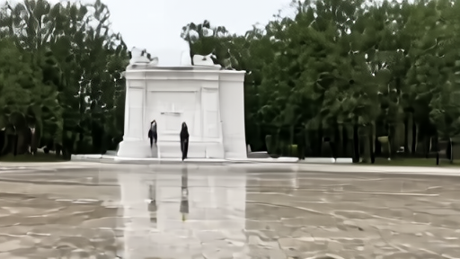
The image the holiday will be remembered through is the one Saturday's brief predicted. President Trump is scheduled to lay a wreath at the Tomb of the Unknown Soldier at noon Monday. The Washington forecast for the noon hour is light to moderate rain, ceiling at roughly 1,500 feet, temperature in the upper 50s, wind from the east at five to ten miles per hour. The wreath ceremony is not weather-cancelable. The Old Guard's Sentinels at the Tomb maintain the rotation every thirty minutes through the summer regardless of weather; the Flags-In ritual at Arlington on May 21 placed more than 228,000 small flags at gravesites in four hours through scattered showers without slowing pace. The choreography is built to absorb rain. What the broadcast will carry at noon Eastern is a wreath, a president, and a steady rain on the plaza.
The Vietnam Veterans Memorial Wall reading at 1 p.m. on the National Mall has the same weather and the same operational answer — the names are read regardless. The Department of Veterans Affairs is administering more than 130 cemetery ceremonies from Friday through Monday, with projected combined attendance near 100,000 across the holiday window; the rain-corridor across the eastern third of the country reduces the on-site number at perhaps half of the VA-administered observances, but does not affect the rituals themselves. The American Battle Monuments Commission's 26 American military cemeteries abroad are running their own ceremonies under their local weather, which in most cases is dryer than Washington's.
The regional split with the West remains the service-journalism fact the national rail has still not led on. Phoenix sits at a forecast high of 91°F Monday afternoon; Las Vegas at 89°F; the central California coast in the low 70s; the Northern Rockies sunny and warm. The USDA's two-hour outdoor-food rule (one hour above 90°F) is the relevant guidance for the West Monday and is not relevant for the corridor from the Carolinas to Maine, where most outdoor temperatures will not approach the threshold. The Coast Guard's cold-water hypothermia guidance from the NWS New York office is the relevant marine note for the Mid-Atlantic and Northeast — Atlantic water temperatures in the 50s incapacitate a swimmer within minutes of sudden immersion regardless of how mild the air reads in the afternoon. The framework the FSIS rule assumes — a hot outdoor day — describes the Mountain West and most of the Southwest on Monday. It does not describe the eastern half of the country.
What the third-day persistence produces operationally is the recalibration the Sunday standard already named, now confirmed by Monday's open. The Memorial Day service rail for the eastern half of the country is rain-corridor flash-flood awareness, cold-water marine warnings, and indoor-attendance contingency at the cemetery ceremonies — not heat advisories or hydration reminders. The Memorial Day service rail for the western half of the country is the heat-and-grill version. Both versions are correct simultaneously. The country has not had this regional split on a Memorial Day weekend since 2017, when a similar blocking pattern produced a similar east-wet, west-dry contrast across the same three holiday days. The pattern is rare. It is not unprecedented.
The forecast does not break tonight. The NWS short-range discussion for Tuesday morning has the front beginning to migrate east, the rain shield retreating toward New England by Tuesday afternoon, and the Washington and Baltimore forecasts clearing into Wednesday. By Tuesday's edition the holiday rail closes and the post-holiday week opens with most of the eastern seaboard drying out — but Memorial Day itself runs under the same forecast the paper called Saturday morning. The wreath gets laid at noon. The rain falls on it. The holiday is the image the forecast produced.
-- DARA OSEI, London