TL;DR
Four forecasting agencies say the same thing about Sunday and Monday — highs in the 60s and rain from Southeast Texas to Upstate New York.
MSM Perspective
FOX Weather, AccuWeather and the WPC discussion all carried the cold-and-wet read; the regional split with the dry West has not been the lead.
X Perspective
Weather X cycled directly from the cleared heat-dome maps into hypothermia and rain-corridor graphics without lingering on the reversal.
Four forecasting agencies — the Weather Prediction Center, FOX Weather, AccuWeather, and the National Weather Service forecast office in Caribou, Maine — describe the same Memorial Day weekend across the Mid-Atlantic and Northeast on Sunday morning. [1][2][3] Highs in the 50s and 60s. Multiple inches of rain forecast in a corridor that runs from Southeast Texas up the I-95 spine into Upstate New York. A high-pressure ridge sitting offshore east of the Carolinas, rotating clockwise, drawing Atlantic moisture inland from the south. Rain that starts Sunday night in Maine and continues through Memorial Day. The Friday-to-Saturday correction the paper carried forty-eight hours ago has held into a third reading.
The paper's Saturday brief on the cold-and-wet inversion named the structural read. The heat-dome frame of Friday — insulin and EpiPens on the household-medicine list, FlyOver heat advisories from Washington to Boston — broke between Friday morning and Saturday morning, when the WPC's discussion reset to a cool-and-wet weekend. The reset has not reversed. Sunday morning's WPC discussion repeats the language. FOX Weather's Memorial Day weekend explainer carries the same forecast: rain and storms across the eastern third of the country, dry and warm across most of the West, Mid-Atlantic and Northeast highs not breaking 70°F through the holiday. [2] AccuWeather's regional outlook describes "wet for millions in east and southeast, dry for most of the West." [3] Three professional forecast products, one reading.
What makes the forecast structurally interesting is not its detail. It is its persistence. Memorial Day weekend forecasts in late May ordinarily oscillate between regional readings as the upper-air pattern shifts day by day. This pattern has not shifted. The high-pressure ridge offshore is a blocking pattern; the upper-level low riding the eastern third of the country is anchored against it. The clockwise circulation around the ridge takes moisture from the warm Atlantic, pumps it north and west, and dumps it inland from the Gulf Coast to the Canadian border. The WPC's Sunday morning short-range discussion describes "potentially heavy rainfall along a quasi-stationary frontal boundary draped from the Southern Plains to the Northeast" — meteorological language for a front that is not moving. [1] A non-moving front is the kind of pattern that produces the multi-day reading.
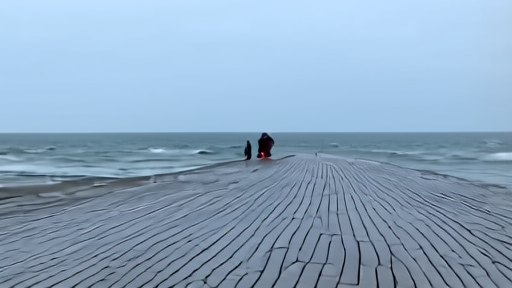
The Caribou forecast office's Sunday public information statement and X post confirm the northern leg of the pattern. Rain is expected to begin Sunday night in northern and central Maine, with totals of one to two inches forecast over the Memorial Day window and locally higher amounts where convective elements develop. [X1] Caribou's office is the National Weather Service node responsible for forecasts across Maine and southeastern New Brunswick; the office's Sunday discussion includes the cold-water hypothermia warning the New York office (OKX) issued Saturday for small craft on the Atlantic coastline. The Coast Guard's annual reminder — wear a life vest, file a float plan, dress for the water rather than the air — is operationally relevant when the air can read mild for a few hours in the afternoon and the water temperatures remain in the 50s. Sudden immersion at those water temperatures incapacitates a swimmer in minutes.
The split with the West is the regional fact the national service-journalism rail has not yet led on. Most of the West sits in the warm and dry sector — daytime highs in the 80s in Phoenix and Las Vegas, low 70s on the central California coast, the Northern Rockies sunny and warming. The temperature-driven food-spoilage guidance USDA's FSIS reissued Friday — the two-hour outdoor cooking limit, the one-hour limit above 90°F — applies in the West. It does not apply across the Mid-Atlantic and Northeast on a weekend when most outdoor temperatures will not reach the threshold. The annual Memorial Day grilling-safety service piece is regionally apt this year, not nationally apt. The framework the FSIS rule assumes — a hot outdoor day — describes half the country and not the other half.
What the Sunday read produces operationally is a service-rail recalibration. The Mid-Atlantic and Northeast service-journalism architecture for Memorial Day weekend — heat advisories, hydration guidance, insulin-storage chemistry, sunscreen reminders — is the wrong rail this year. The right rail is rain-corridor flash-flood awareness, cold-water hypothermia warnings for small craft, and the indoor-attendance probability the cold weather drives at the ABMC's twenty-six American military cemeteries abroad and the more than one hundred and twenty ceremonies the Department of Veterans Affairs is running at national cemeteries from Friday through Memorial Day. The ceremonies happen rain or shine. The attendance numbers, projected at about a hundred thousand for the VA-administered observances, are weather-dependent. A persistent rain pattern across the eastern third of the country reduces attendance at the eastern observances. It does not reduce them in San Antonio or in Phoenix.
What Sunday morning leaves open is the Memorial Day Monday verdict at Arlington. President Trump is scheduled to lay a wreath at the Tomb of the Unknown Soldier at noon Monday. The Vietnam Veterans Memorial Wall ceremony in Washington follows at 1 p.m. The Tomb of the Unknown Soldier wreath ceremony is not weather-cancelable in the ordinary sense — the Old Guard's Flags-In observance at Arlington on May 21 placed more than 228,000 flags at gravesites in four hours regardless of weather. The wreath gets laid. The Washington forecast for Monday is showers, high in the upper 50s. The image the broadcast will carry from Arlington at noon Eastern is a wreath, a president, and a steady rain. The cold-and-wet frame the paper called Saturday is now the image the holiday will be remembered through.
-- DARA OSEI, London
Sources & X Posts
News Sources